 Digital Forestry Mapping in Columbus, GA
Consoletti GIS Services

Why would a consultant use Consoletti GIS Services?
Any forestry consultant can use Google Maps or any number of free forestry mapping software to generate a sale map for a logger or a shaded stand map for a contractor. Consoletti GIS Services (CGS) uses the GIS industry standard Arcmap software to generate your digital forestry map, georectify it, and create a map product to your specifications for your contractor or landowner. CGS will maintain your map library for consistent, updated map generation in future years.
Bill Consoletti, owner, worked in the Technical Services Departments of forestry industry companies in Georgia and Alabama for more than 30 years, and he brings all that experience using Arcmap to capture and edit forestry stands to your project.
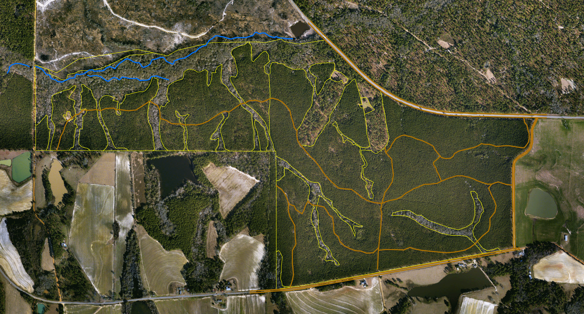
CGS will use your tracts to acquire current imagery to capture recently harvested stands for accurate acreage calculation.
Leave a message below or contact Bill Consoletti at 706-617-9456.
Services

Online ESRI Map Resources
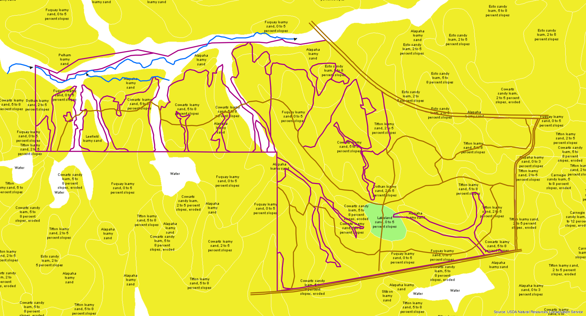
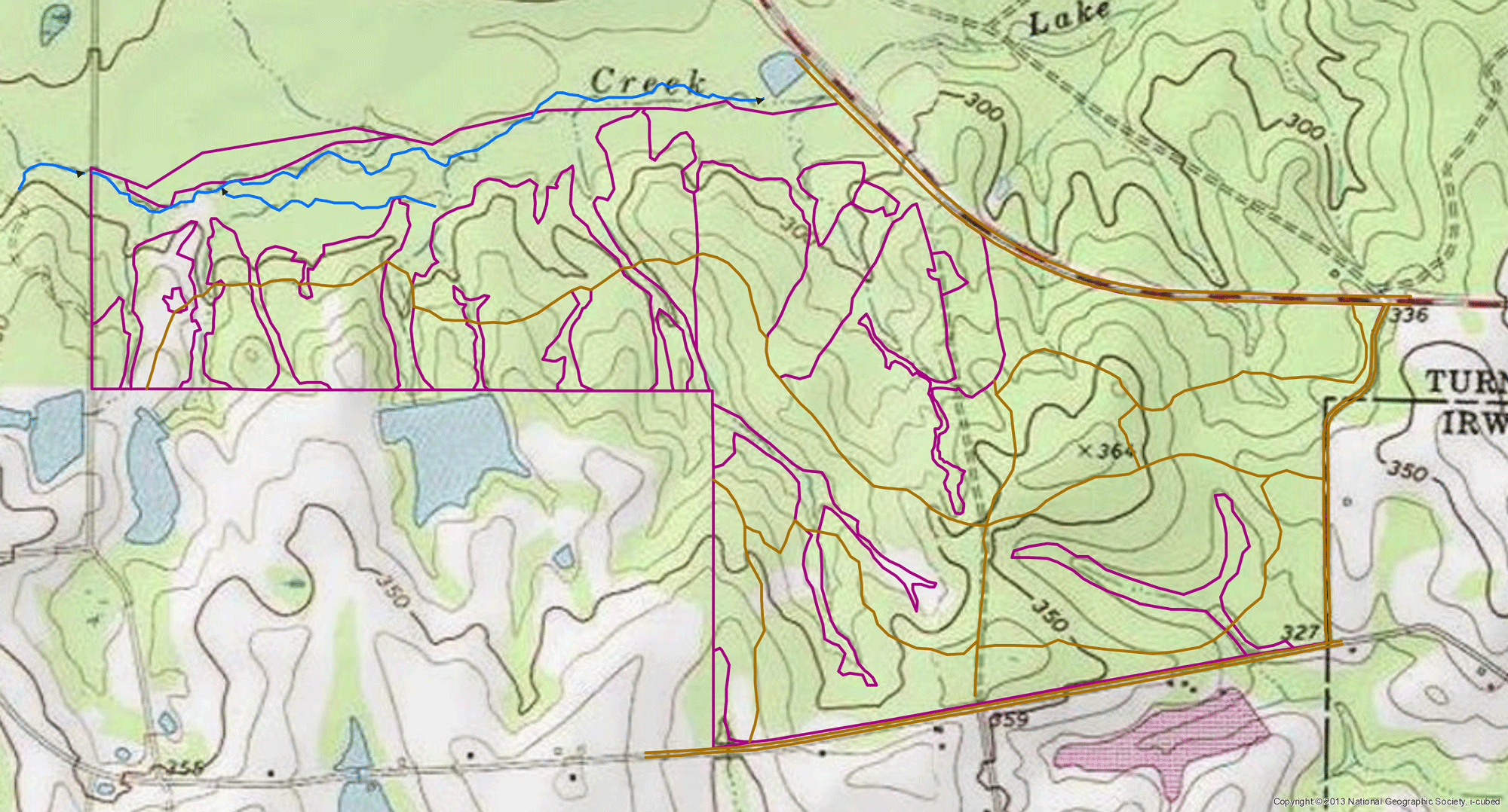
Soil, topo, street map and imagery to help interpret your timber stands

Timber Stand Photointerpretation
Tabular data amendments

Imagery Acquisition
Photointerpretation and delivery of CIR and natural color imagery included
Connect with Us


Address
3650 Ginger Drive
Columbus, GA 31909
706-617-9456
